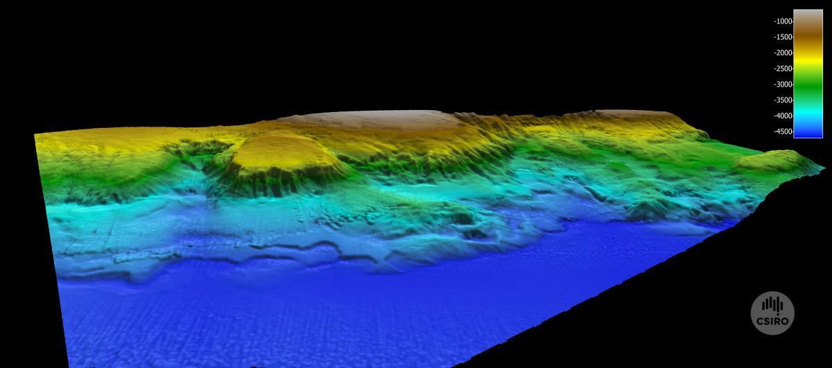
seafloor mapping
All abyss blogs
- 16 June 2017
- 15 June 2017
- 14 June 2017
- 13 June 2017
- 12 June 2017
- 11 June 2017
- 10 June 2017
- 9 June 2017
- 8 June 2017
- 7 June 2017
- 6 June 2017
- 5 June 2017
- 4 June 2017
- 3 June 2017
- 2 June 2017
- 1 June 2017
- 31 May 2017
- 30 May 2017
- 29 May 2017
- 28 May 2017
- 27 May 2017
- 26 May 2017
- 25 May 2017
- 24 May 2017
-
Orbs, paddles, spines, ejecting jaws and silky smoothness: meet the polychaetes of Australia's abyss23 May 2017
- 22 May 2017
- 21 May 2017
- 20 May 2017
- 19 May 2017
- 18 May 2017
- 17 May 2017
- 16 May 2017
- 15 May 2017