


Sequence for collecting data - cruise planning to swath mapping then towed camera:
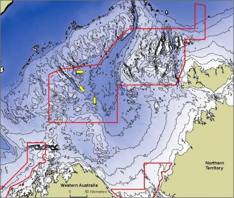
Figure 1: Pre-cruise planning location map showing proposed Oceanic Shoals Commonwealth Marine Reserve and three sample grids for this survey.
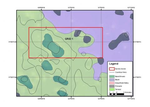
Figure 2: Pre-cruise Grid 1 detail using the limited available bathymetry. A shoal feature is crudely indicated in darker green.
Figure3: Grid 1 partial swath coverage. Lines are run by the RV Solander, a bit like mowing the lawn, to incrementally cover the study site. The detail is vastly improved from existing knowledge.
Figure 4: A completed multibeam image from Grid 1. The shallower shoal feature
Figure 5: Scientists working on the ship prepare the data as it is collected.
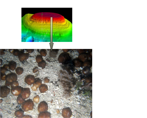
Figure 5. Digital elevation model for part of Grid 1, showing the shallower shoal feature. The multibeam data is digital enabling complex visualisation and analysis by computer.
Figure 6: Targeted towed camera surveys then reveal the habitats. In this example the shallower shoal plateau area in Grid 1 is seen to support mushroom corals, various plants and coarse calcareous rubble
- Log in to post comments