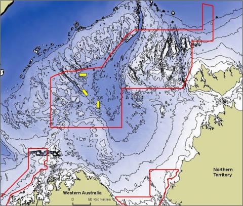
Image 1 - Pre-cruise planning location map showing proposed Oceanic Shoals Commonwealth Marine Reserve and three sample grids for this survey. See yellow polygons in centre of image. Grid 1 (top) to Grid 3 (bottom).
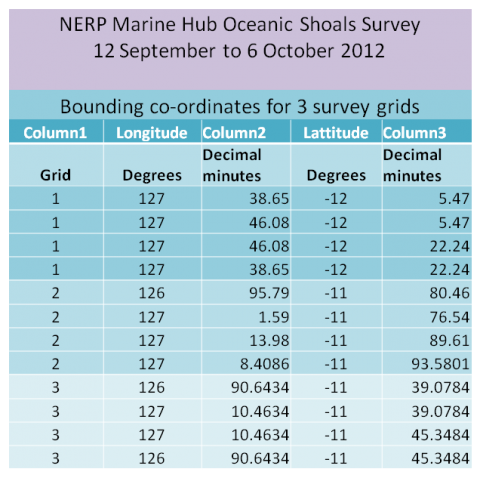
Image 2 - Bounding co-ordinates for the 3 survey grids.