This 'emerging priorities' project surveyed marine life across the Bremer offshore region, including Bremer Commonwealth Marine Reserve.
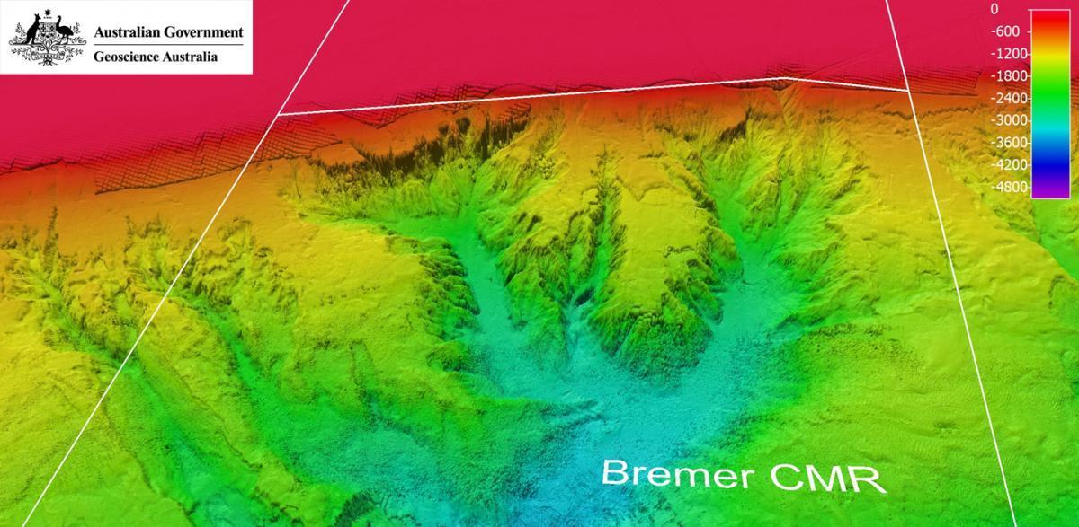
Some 70 kilometres south-east of Bremer Bay off southern Western Australia, a group of canyons etched into the slope of the continental shelf plunge from depths of 200 to more than 1000 metres. Above the canyons, pelagic wildlife aggregates in high numbers, including whales, giant squid, and seabirds. Seasonal orca concentrations here are unprecedented, with more than 100 individuals in the local population, many of which are regularly sighted. This profusion of visible and awe-inspiring marine life supports a thriving ecotourism industry, but little is known about the factors underlying the abundance and diversity.
A collaborative Marine Biodiversity Hub project led by University of Western Australia surveyed marine life across the region, both inside and adjacent to the Bremer Marine Park (AMP) which extends to the edge of the continental slope. Knowledge gained during the 12-month project will support Australian Government decision-making to protect the environment and biodiversity and allow for sustainable use, and prioritise future research. This includes management decisions relating to the Bremer AMP, as well as the Albany canyon group and adjacent shelf break, which are identified as key ecological features in the South-West Marine Bioregional Plan.
Project components
Workshop
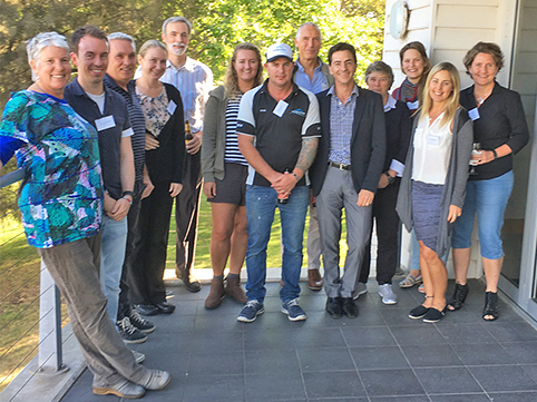
A workshop in late 2016 gathered the perspectives of scientists, managers and external stakeholders. The workshop built on a literature review, identified additional data sources and recommended research and management priorities.
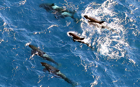
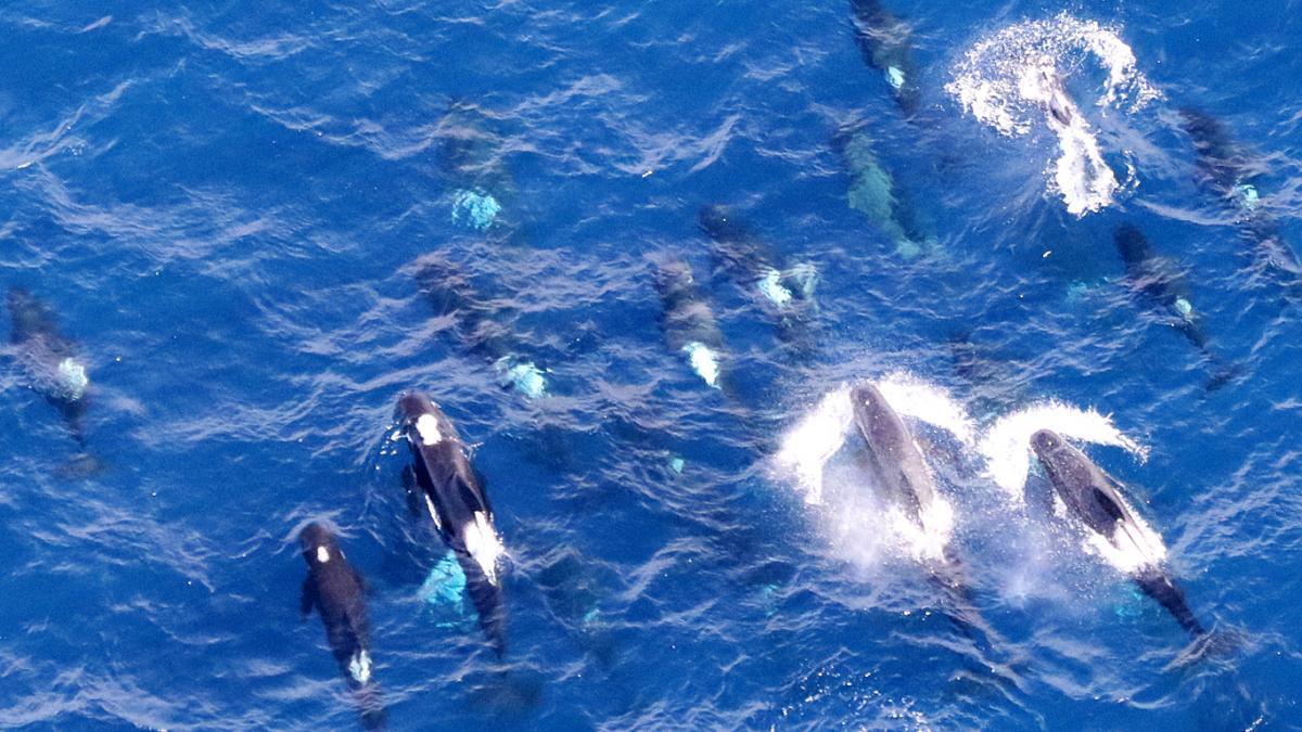
Orca aerial survey
Aerial surveys were conducted in March 2017 with two observers flying onboard a chartered aircraft. The survey team from Curtin University’s Centre for Marine Science and Technology and UWA recorded the occurrence and distribution of large marine wildlife along transects that crossed the Bremer AMP and known aggregation area. An additional survey focussed on the aggregation area. Sightings of marine megafauna included killer whales, sperm whales, long-finned pilot whales, large sharks and dolphins.
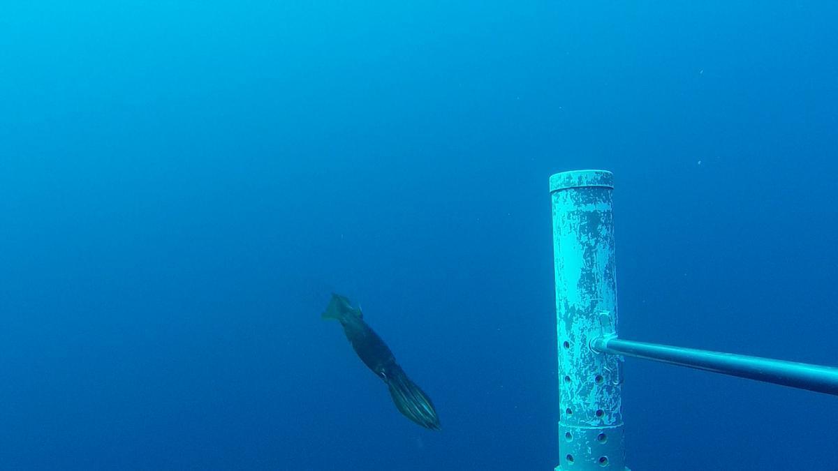
Pelagic fish survey
A 10-day mid-water baited remote underwater video systems (BRUVS) survey of the Bremer CMR and aggregation area led by UWA took place in February─March 2107. One hundred BRUVS deployments documented the diversity, abundance and biomass of pelagic sharks and fishes.
Orca tagging
Attempts were made to tag adult orca to clarify their foraging habits and distribution both inside and outside the Bremer CMR. The tags, known as Low Impact Minimally Percutaneous External-electronics Transmitter (LIMPET) satellite tags, are attached to the dorsal fin of orcas (conditions permitting) by researchers form Marine Information and Research Group Australia. If successful, the tagging study will trace the animals’ fine scale movements and residency patterns, and yield deeper insights into foraging behaviour and diet through dive profile data. Existing data from acoustic surveys and orca sightings will help to identify patterns of orca distribution and behaviour in the aggregation area.
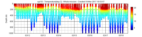
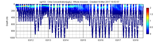
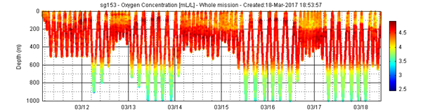
IMOS ocean glider deployment
An Integrated Marine Observing System (IMOS) Seaglider has been deployed in the Bremer offshore region since March 2017 for a six-week oceanographic investigation. After three weeks, the glider had made more than 150 ‘dives’ to depths of up to 1000 metres, measuring sea temperature, salinity and biogeochemical parameters along repeat, sawtooth transects. It has detected patterns in seawater temperature, salinity and oxygen content (see plots) that appear to indicate different water masses overlying the canyons.
The Bremer glider data and more information on IMOS gliders is available, and all IMOS data are freely available on the Australian Ocean Data Network Portal.