June 25, 2018
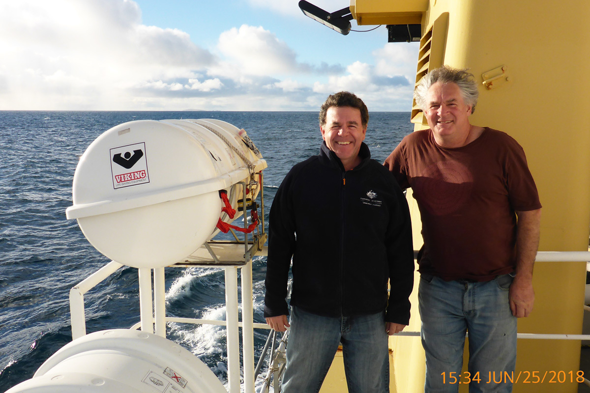
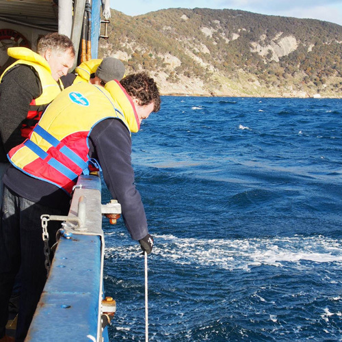
Scientists from Marine Biodiversity Hub partner agencies the University of Tasmania Institute for Marine and Antarctic Studies (IMAS) and Geoscience Australia (GA) are out mapping the seabed in the Beagle Marine Park. Neville Barrett of IMAS and Scott Nichol of GA took time out while sheltering from wild weather to answer questions about their Bass Strait adventure.
What areas are you mapping?
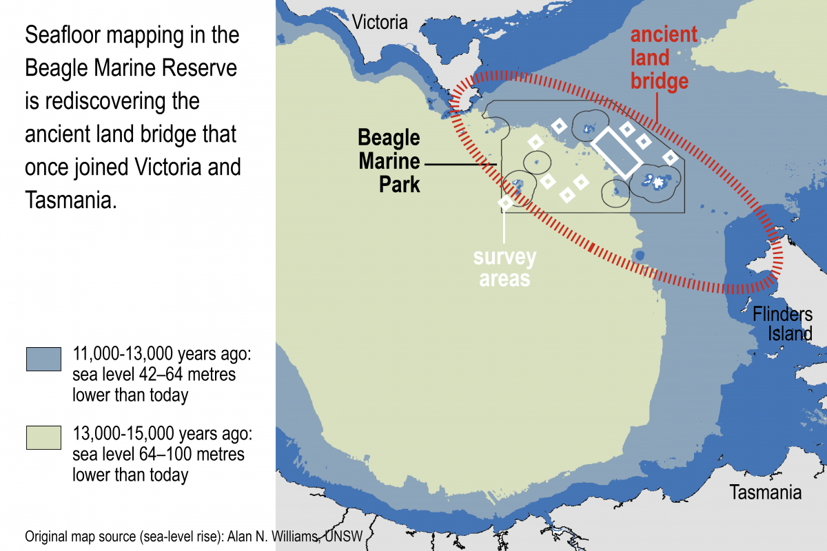
We’re mapping the seabed in the Beagle Marine Park, which bridges the Tasmanian and Victorian borders in north-eastern Bass Strait. Much of the mapping is taking place between the Hogan and Kent groups of islands – stepping stones between Wilson’s Promontory and Flinders Island – and Curtis Island further west. (The Hogan Group was the first group of islands to become isolated by rising sea levels after the last ice age.)
Why are you mapping these areas?
The motivation for mapping is twofold. First, it is to build insight into a previously unknown environment. Our aim is to map the major habitat and geomorphological features of the seabed that otherwise lie hidden below the sea-surface. By using multibeam echo sounder (MBES) swath mapping we can visualise the seabed in 3D over extensive areas, providing maps that can be appreciated by the wider community.
Secondly, the mapping will be used to plan subsequent biological surveys to further our understanding of the biodiversity values of the marine park. (These surveys will take place in July and August 2018.) Distinct features such as reef and sand provide habitat for marine life, so are logical places for us to deploy biological sampling equipment such as baited remote underwater cameras, remotely-operated vehicles and towed cameras.
Furthermore, the mapping and biological surveys will support management and monitoring by Parks Australia, and demonstrate a viable and affordable approach to inventory and monitor other Australian Marine Parks. This includes providing a basis for evaluating the effectiveness of habitat protection zoning relative to adjacent fished areas.
What will the mapping reveal?
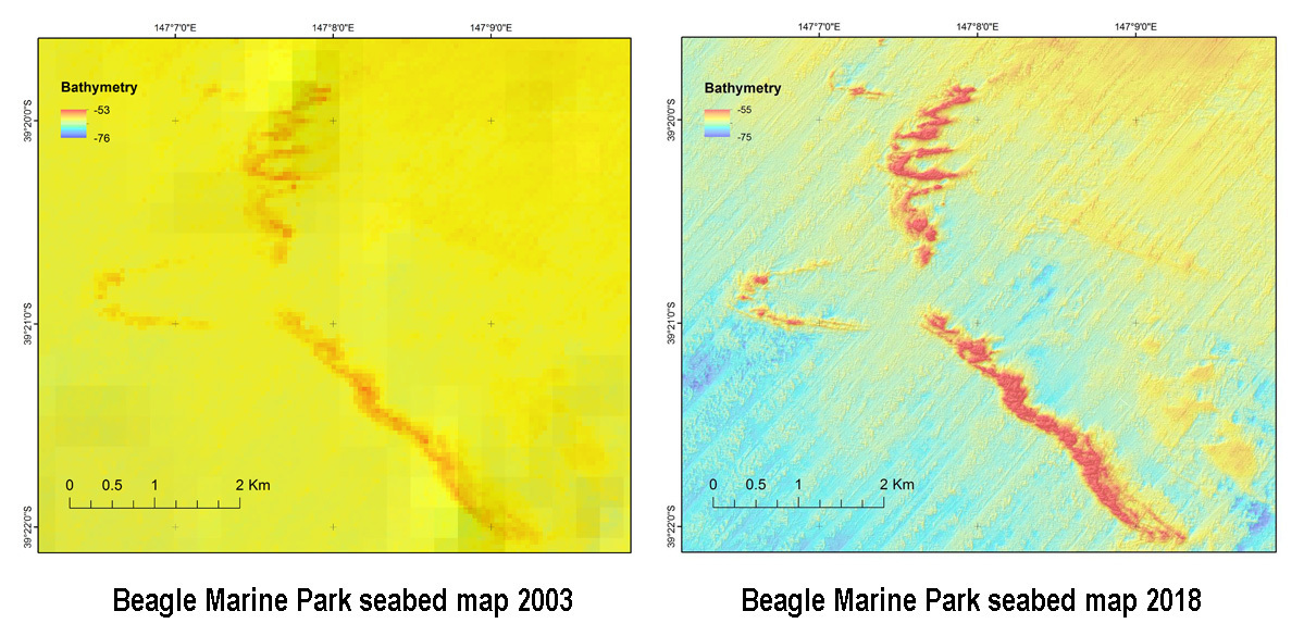
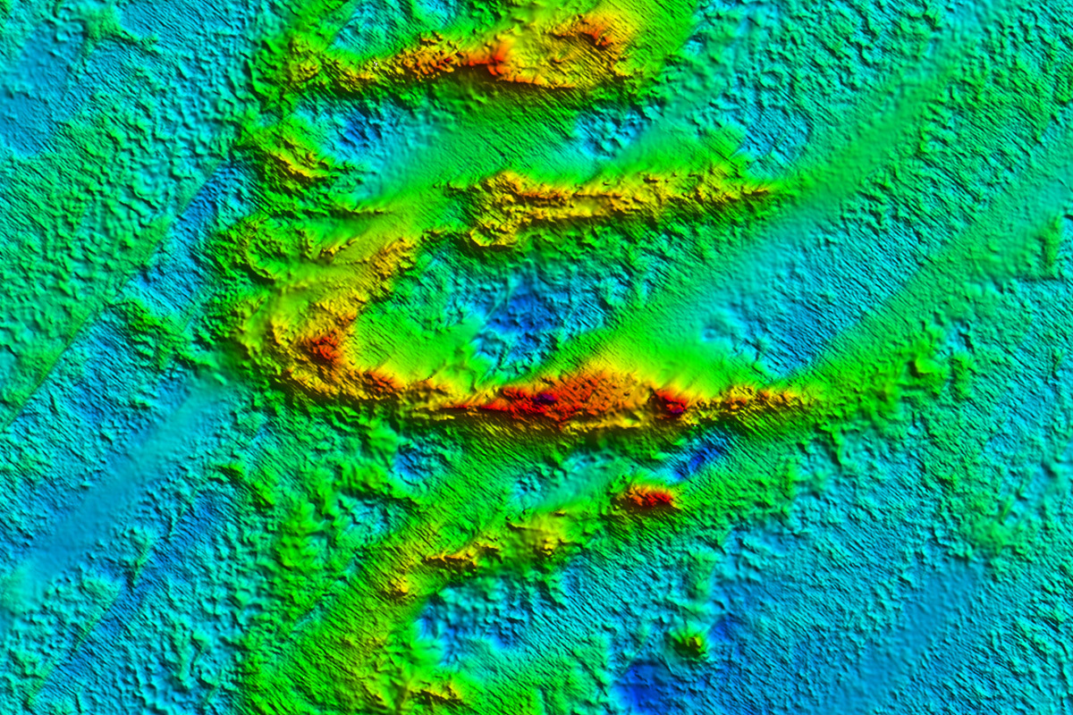
For much of the marine park there is very little mapping at a resolution that reveals seabed features such as outcropping reefs, or mobile bedforms (geomorphology). Historical naval mapping has outlined isolated ridges/reef outcrops between the Kent and Hogan island groups, but the detail is insufficient to describe these features adequately or to plan biological surveys.
The new mapping is at metre scale resolution horizontally, and much finer vertically so can reveal an extensive degree of detail for this region (see maps). This fine resolution allows reef to be differentiated from sediments, and low profile reef to be differentiated from more fractured/complex reef. As these habitat characteristics (and more) are important in structuring the biological communities present, the information is of great value in planning biodiversity surveys. This fine-scale information is also invaluable in interpreting the bedforms present, and the processes that may have formed these historically.
What you are hoping to find?
We are hoping to develop an adequate description of the seabed geomorphology and habitat distribution in the park, as well as furthering our understanding of the geology of Bass Strait and the nature of the land-bridge that once joined Victoria to Tasmania. Certainly land-bridge features are of interest (although not a central driver of the survey) as is any new understanding of the variety of seabed features and habitats in this region.
How is the mapping being done?
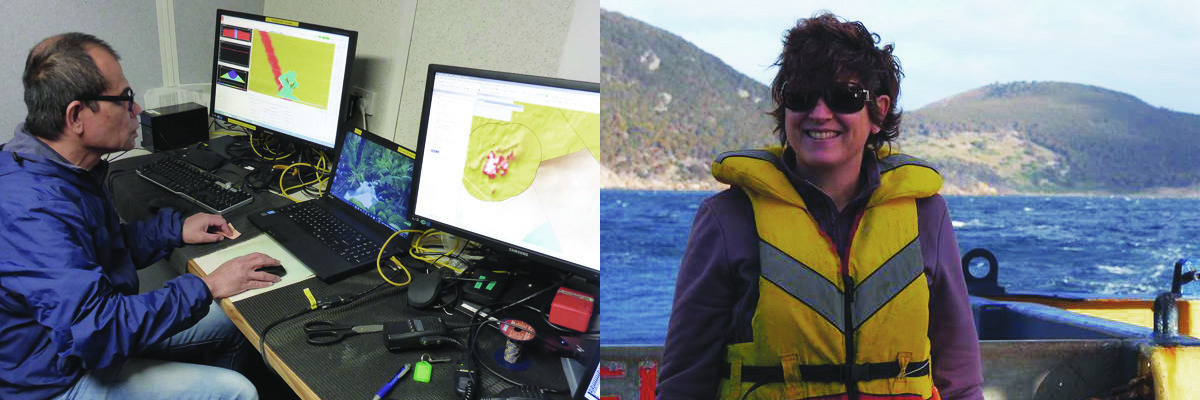
We are using a state of the art Kongsberg 2040c multibeam sonar fitted to the University of Tasmania (Australian Maritime College) Training Vessel Bluefin. This system maps a swathe of four to five times the water depth, which during this voyage is about 60 metres. The swathe is therefore 250 m wide and about 200 m per “pass” with some overlap. It’s a somewhat slow process to build up a broad area map, but we covered more than 240 square kilometres in our first three days.
Are there any particular geological features of interest?
Before survey we were aware that the area was likely to be an extensive area of soft sediment with potential for some very limited outcropping of rocky ridges of unknown origin. The mapping up to day four suggests that this is the case, although there may be more widespread reef outcrop (eroded pavement), but at very low profile. However, some of the potential low profile reef area will require future validation using additional equipment. The linear and eroded nature of the outcropping ridges suggests they may be relict dune features.
Outcropping ridge features are of particular interest as they are both rare in this region and likely to be an important substrate for sponge gardens, a key biological feature underpinning the initial planning for this marine park. Understanding their nature and spatial distribution is therefore a central focus, as is making a quantitative inventory of the proportional cover of the key habitat types in the park.
What is a relict dune?
A relict dune is a former terrestrial sand dune that has survived sea-level rise and is likely to be composed of cemented sand that allowed the dunes to harden prior to eventual inundation as sea levels rose. So some of this area would have been dune fields prior to inundation of the land bridge. Not surprising given it would have been very sandy and windy during the last few glacial periods! These are somewhat analogous to the drowned dunes that we mapped in earlier surveys of the Freycinet Marine Park, but are nowhere as near as extensive. The dunes we see here are much sharper, in some places exposed and rocky.
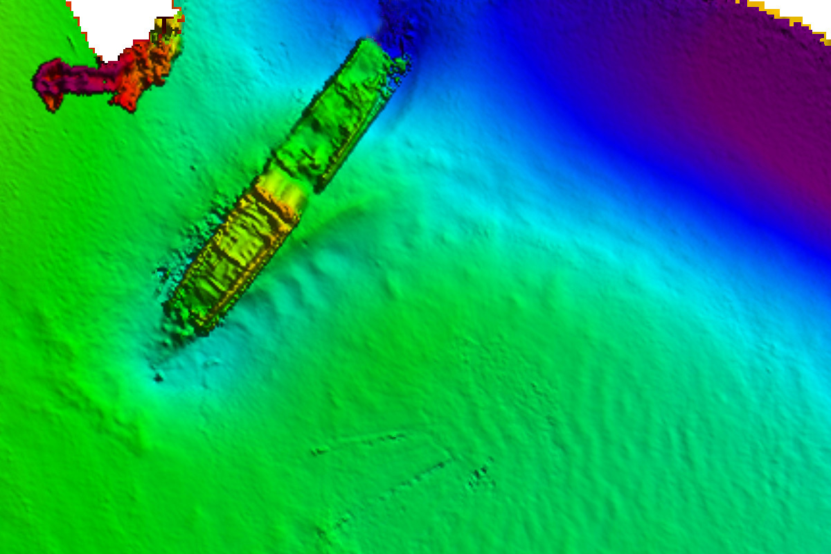
Mapping the SS Bulli wreck
Further reading
- Log in to post comments