January 22, 2020


A Marine Biodiversity Hub team has embarked on a two-week voyage to survey seafloor habitats and biodiversity at Elizabeth and Middleton reefs.
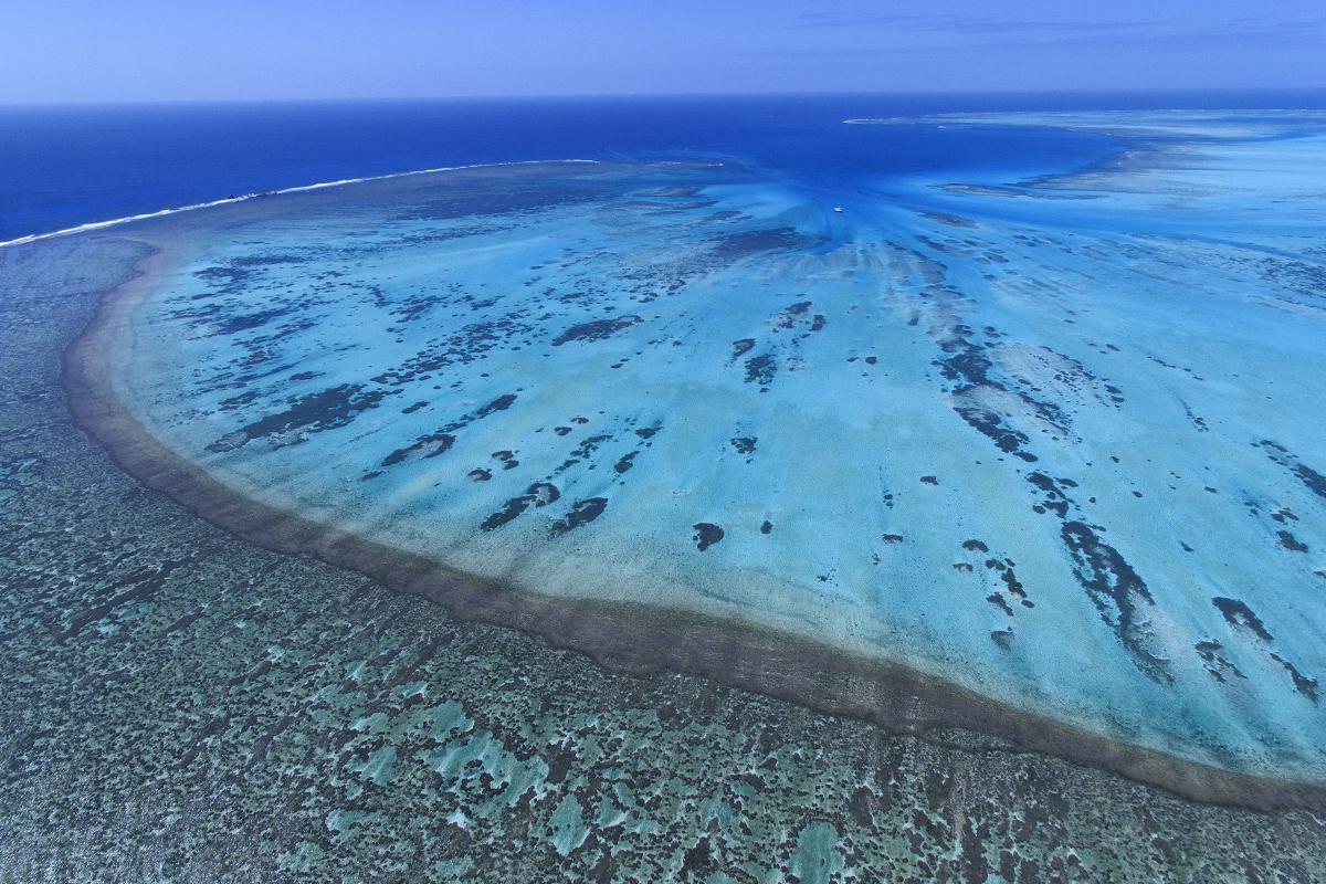
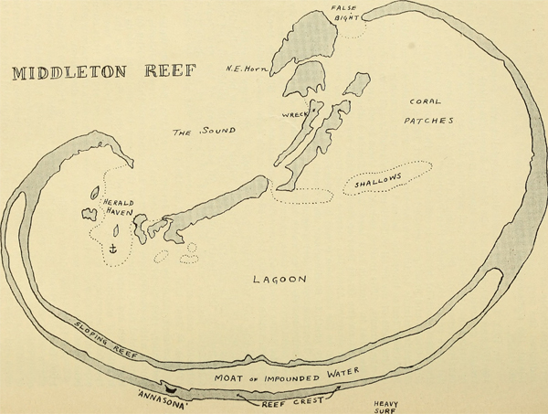
Elizabeth and Middleton reefs are atoll-like structures, or platform reefs, associated with the Lord Howe seamount chain. They lie within the Lord Howe Marine Park, some 550 kilometres east of Port Macquarie, New South Wales, and support a unique collection of diverse tropical, subtropical and temperate marine life.
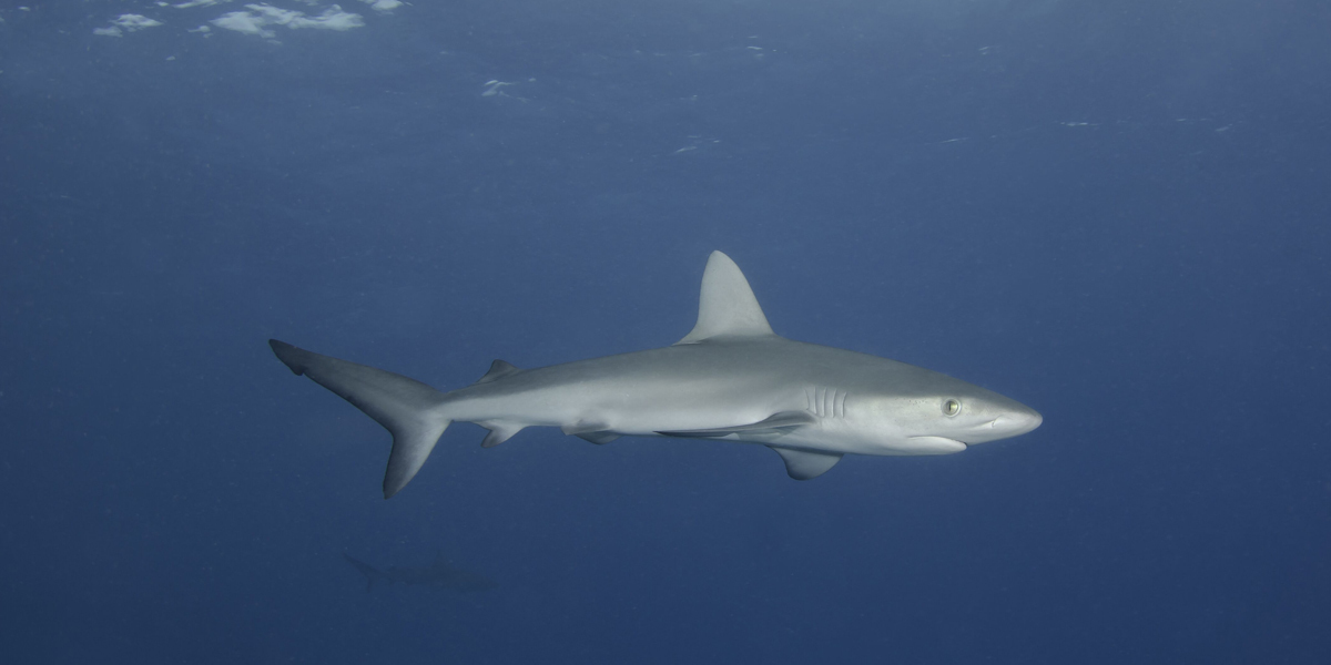
Elizabeth and Middleton Reefs are listed as wetlands of international significance under the Ramsar Convention. They host hordes of seabirds and shorebirds and their lagoons are home to Galapagos sharks and the rare black cod.
Limited mapping of Elizabeth and Middleton reefs has revealed complex seabed seafloor features, including low profile ridges and mounds. A deeper knowledge of the area’s habitat, biodiversity and ecology is needed to support monitoring and management by Parks Australia.
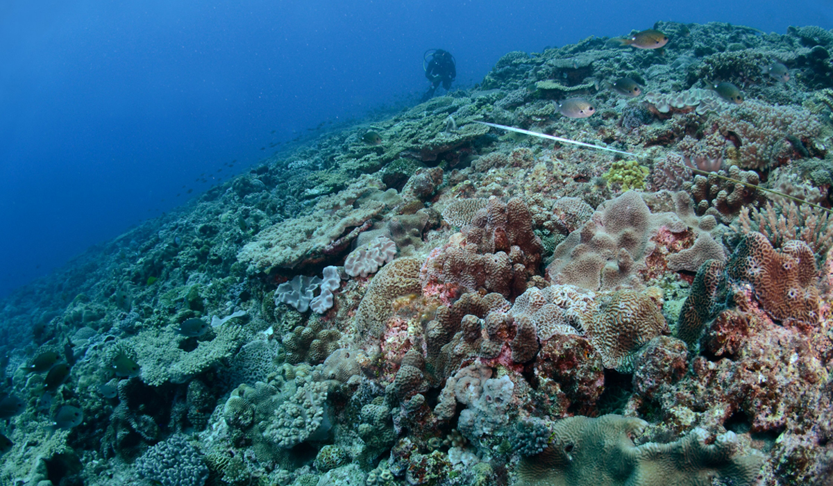
“As ocean temperatures rise, a pressing global challenge is to better understand the distribution and characteristics of critical habitats that support mesophotic (80–120 metre depths) and deep-water coral communities,” voyage leader Dr Andrew Carroll of Geoscience Australia says.
“At the remote, little-studied Elizabeth Reef and Middleton Reef in the Lord Howe Marine Park, we want to understand what role the seamount reefs may play as refuges for coral and other seafloor and pelagic (open ocean) communities in a warming ocean.
“We will map and characterise the structure of the reefs, the habitats they provide and the life they support to reveal their formative geological processes and present-day key ecological features.”

The survey team includes 16 researchers and technicians from Geoscience Australia; the Institute for Marine and Antarctic Studies, University of Tasmania; the Australian Centre for Field Robotics, University of Sydney; and the Department of Primary Industries, NSW. A representative from Parks Australia is also aboard.
They set out from the Port of Newcastle in late January on the TV Bluefin, heading for the northern reaches of Lord Howe Marine Park. Here they will spend eight days acquiring seafloor bathymetry, imagery, seabed samples and shallow sub-surface data, guided by standard operating procedures developed by the Marine Biodiversity Hub.
An autonomous underwater vehicle will be used to gather imagery of biological communities across reef and sediment habitats, baited remote underwater stereo video systems will record mobile species, and a remotely operated vehicle will survey areas of outer reef.
Snorkel surveys within sheltered waters of the lagoons will allow measurements of black cod, and sediment samples will be taken to characterise substrate types. During daylight, the survey team will maintain a watch for marine mammals.
“The survey will significantly increase knowledge of key ecosystem features and seafloor communities in the northern Tasman Sea, where little is known of the ecological significance of the remote seamounts, shelves and reefs,” Dr Carroll says.
“It will provide a baseline for assessing assess the condition of mesophotic reef habitats, and comparing marine life in different protection zones (Middleton Reef is in a National Park Zone and Elizabeth Reef is partly within a Recreational Use Zone).
“This will also enable predictions of the broader distribution of similar environments that support critical deep-water biological communities.”
This survey is part of the Hub Project D3: Implementing monitoring of Australian Marine Parks and the status of marine biodiversity assets on the continental shelf, and has been designed in consultation with Parks Australia.

- Log in to post comments
