December 9, 2018
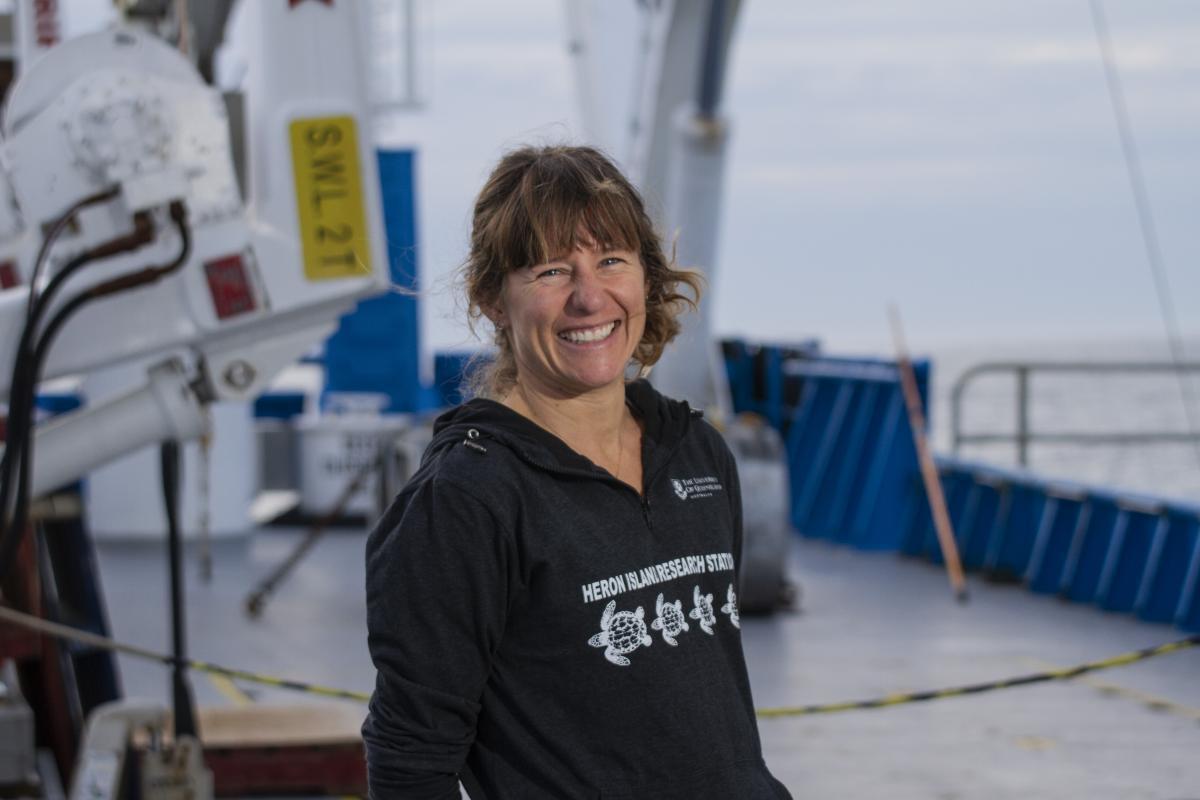
 Day 16: Kylie Maguire, Southern Cross University
Rolling around in the Southern Ocean on Investigator I feel excitement and awe at the wild ocean. Her blue, slowly being replaced by white is the result of 40-something knots of wind. Beam trawling and camera tow operations have been put on hold, however despite the conditions, the science continues. The ship is now conducting swath bathymetry mapping – vital for mapping and modelling the seafloor. This means the ship follows a navigation course, turns around, and follows that same course again: just like mowing the lawn.
Being inside, it is easy to underestimate the conditions outside. She handles the swell considerably well, though, when the ship changes course and turns around (to map the sea floor) we inevitably face side on to the direction of the swell. Just after dinner we did just that and the ship rolled to an angle of 21.6°: a fair roll for a vessel of seven levels.
My hat goes off to the crew, as they are always there when needed, particularly during a trawl operation which requires chilling, sorting and preserving of specimens immediately after retrieval. I feel incredibly lucky to be here. So far, I have helped with biological sorting, ocean profiler deployments (for biochemistry), bird observations, and video scoring (annotations). Being surrounded by so many scientists specialising in different fields is equally inspiring as it is confronting. Four and a half years at university and I still haven’t found my ‘niche’. What I do know is, is that I am drawn to science that underpins conservation.
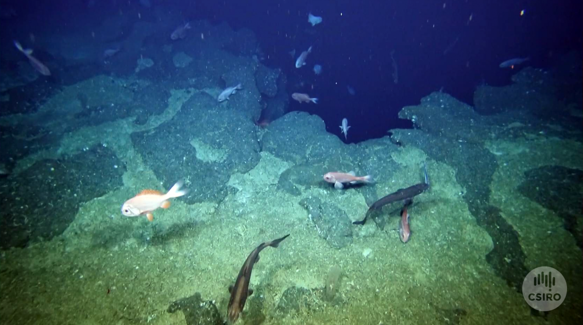
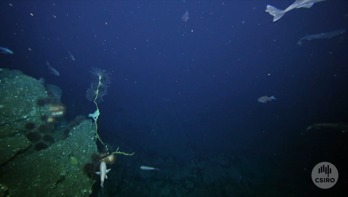
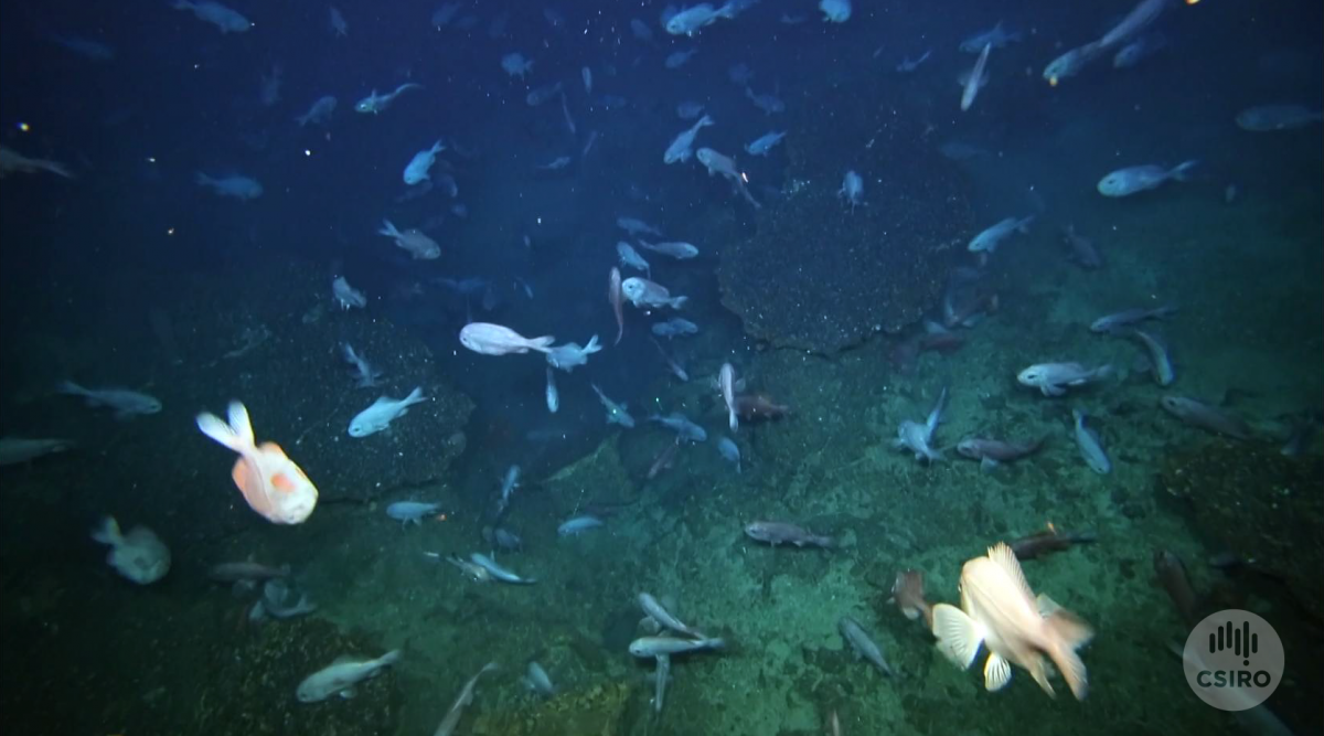
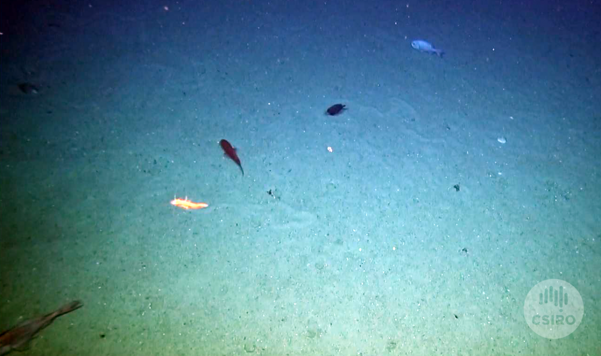
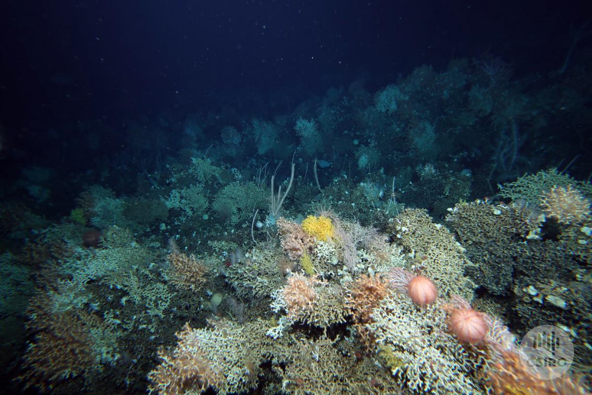
I joined this vessel as an intern, the final component to completing my Bachelor of Environmental and Marine science. My role onboard is to annotate the footage of the camera tow surveys, used to identify the spatial distribution of the benthic substrate and biota present. For example, is the seamount predominately bare rock, coral rubble, or even better, coral reef? This course scoring means I get to watch hours and hours of footage of the deep-sea; the weird and wonderful deep-sea corals, fishes, sharks, rays, cephalopods and other invertebrates. I absolutely love this – it is like watching a BBC documentary only David Attenborough’s voice is replaced by my random mix of music (essential for the long hours of concentration).
We are more than half way through the trip, and I am still blown away by the diversity and extent of the coral reefs I am watching while scoring the transects. On that note, I’ll wrap up this blog and head down to the dry lab to continue my deep-sea documentary wonder (whilst annotating, of course) ;)
Notes on today's activities, from Marine Biodiversity Hub Director, Nic Bax . . .
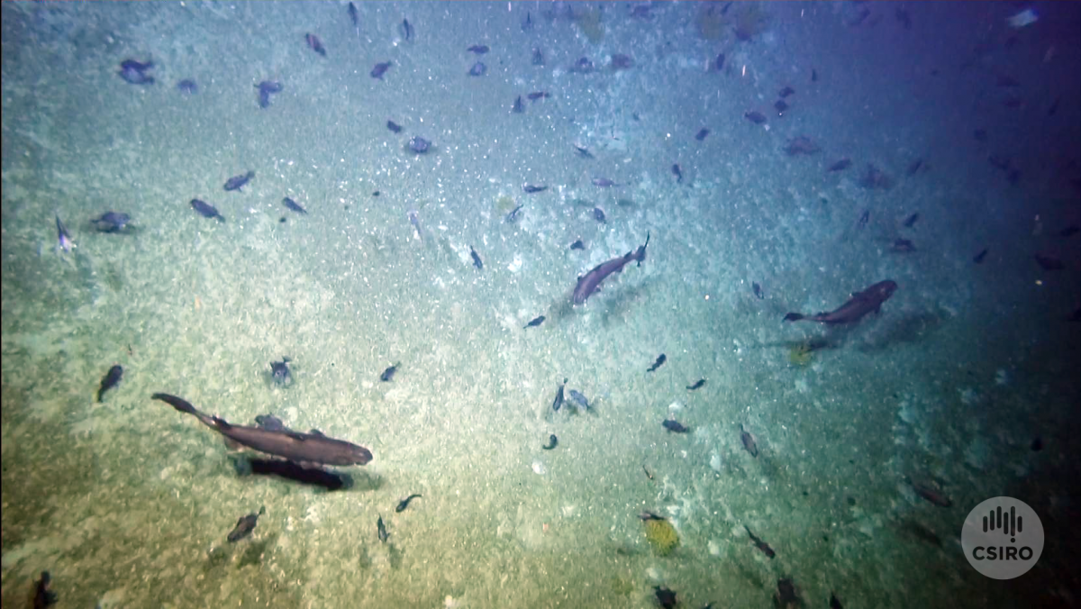
A busy day for the deepwater towed camera and ship’s crew with 12 operations initiated, but three cancelled when the camera veered too far off course. Strong currents around two of the seamounts, Z16 and Hill U, complicated the targeting off several tows, with the ship having to start well upcurrent of the transect so that as well over a kilometre of cable was let out, the camera would end up at the start of the transect. Add to that the change in tow depth of the camera and consequently the amount of wire out as the ship slows to the one knot towing speed (a speed at which there is little manoeuvrability against prevailing surface current and wind) and it all gets quite complicated requiring good communication between the camera operators and ship’s crew.
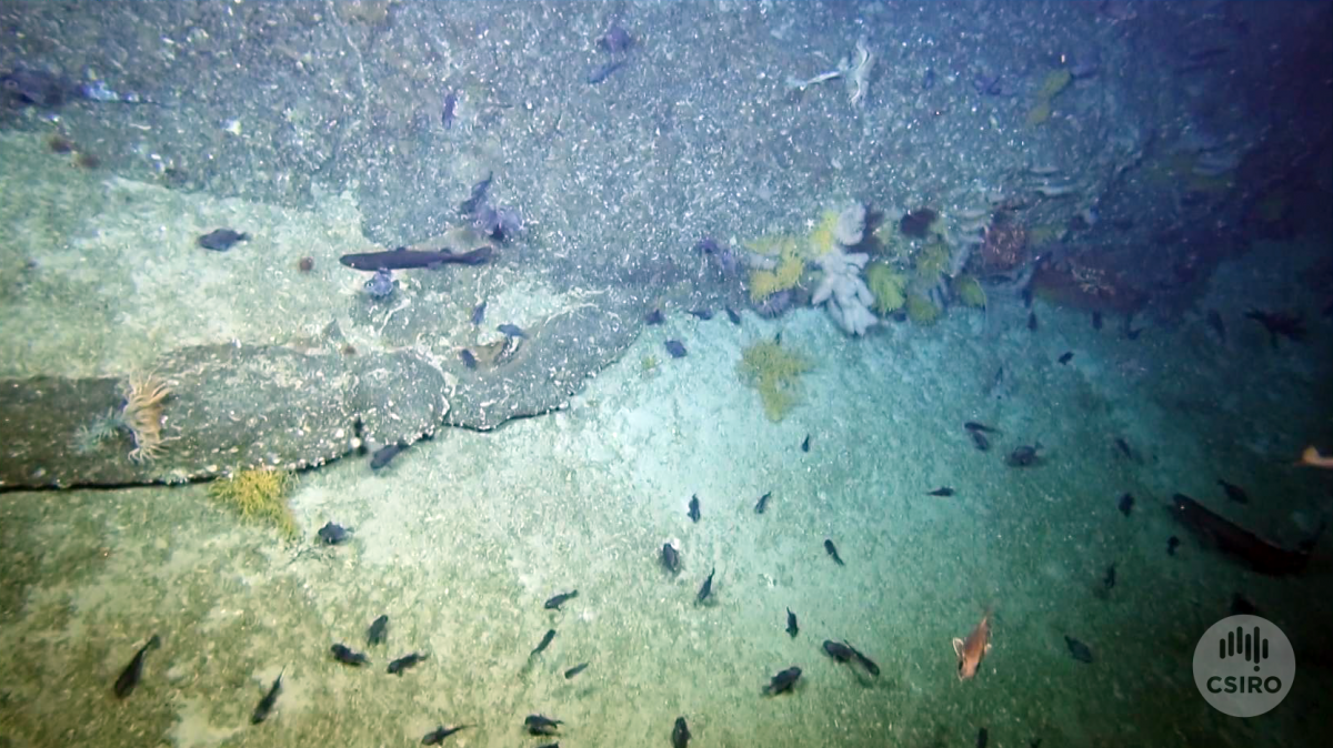
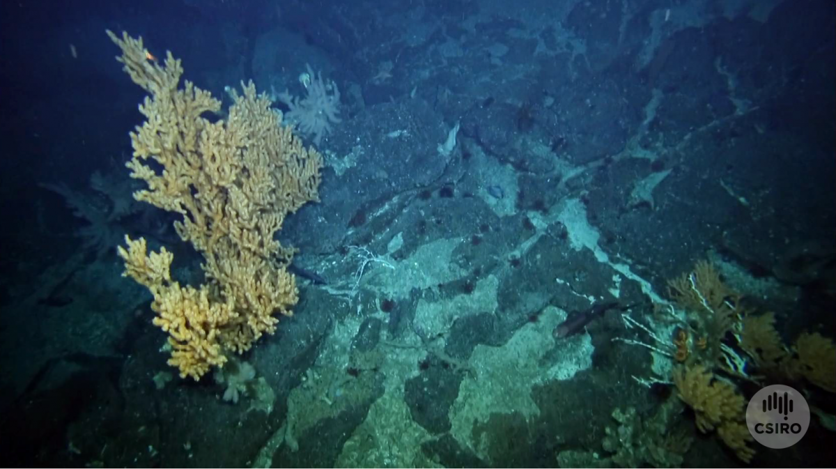
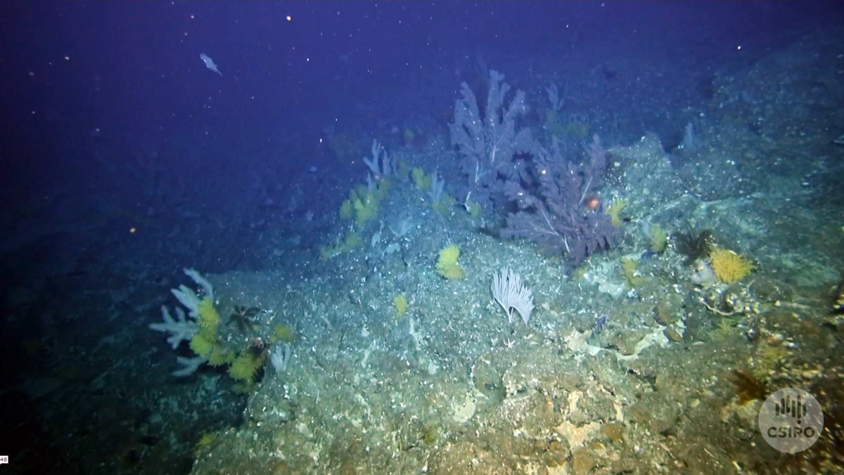
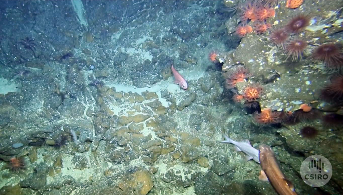
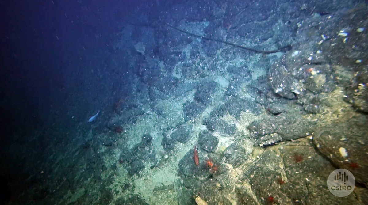
There was time left for two transects searching for deepwater corals and each was rotated slightly to pick up an additional hill or mound. The first transect and continuation included three peaks with good coral cover from 1100 (or highest point) to 1250 or 1300 depending on hill, with clumps and tufts could be observed until 1300–1380 depending on hill. Smooth oreo were frequently observed, as well as urchins, octocorals and sponge on the coral matrix. The sediment plains between the hills included much coral rubble.
The second transect was deeper at >1500 m on a flat gravelly sediment plain. No coral matrix was observed, but yellow urchins were abundant, with octocorals on irregular rock outcrops. The ad hoc transect picked up “Belinda’s Dory Hill” showing good coral coverage from 120–1220 m with lots of octocorals and some large black corals. The coral matrix thinned rapidly and was essentially gone by 1270 m, with possible signs of physical disturbance.
The green flash was captured on camera at sunset with science fact (or was it art) finally overcoming the division between believers and non-believers on board. If only it was always this simple.
- Log in to post comments