June 7, 2017
 Day 24: Matt Marrison, Marine National Facility communicator
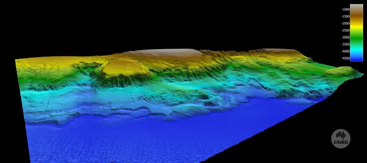
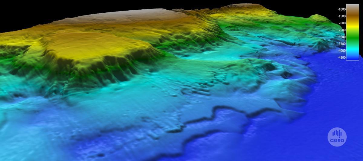
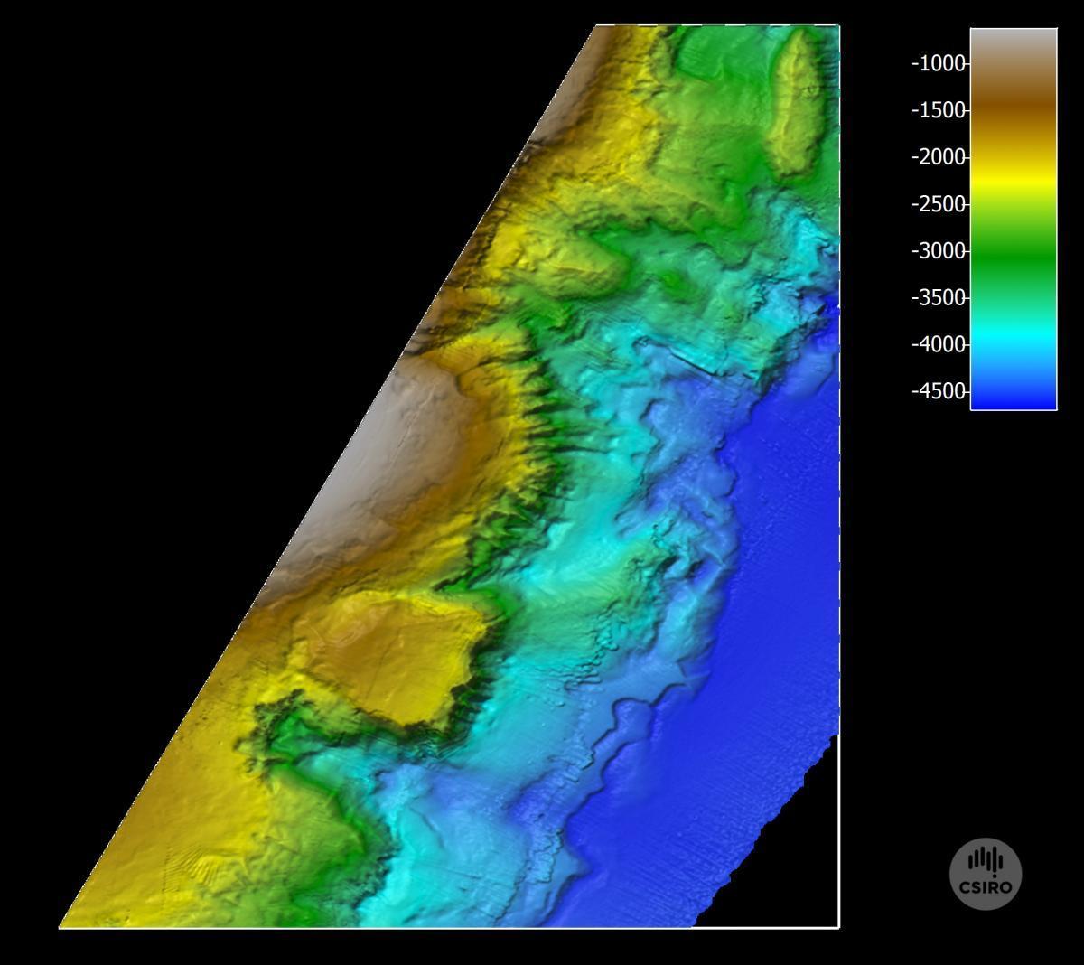
A marvellous world of complex canyons, steep cliffs, and boulder fields has been revealed in the first full coverage, high-resolution map of an Australian Commonwealth marine reserve (CMR). The map of the East Gippsland CMR off eastern Victoria was produced by Amy Nau and Bernadette Heaney from the Geophysical Survey and Mapping Team onboard the CSIRO research vessel Investigator. It provides a street view of the homes of many of the weird and wonderful deep-sea animals being found on the voyage to Australia’s eastern abyss.

These maps are produced using the advanced geoscience equipment hidden beneath the waterline on Investigator. Attached to the ship’s hull is a steel housing called a gondola, which contains the latest multibeam sonar technology. To optimise acoustic performance, the ship is designed to be ‘DNV-Silent-R compliant’. This is achieved through the careful design of the ship’s hull, and by minimising noise from onboard machinery.
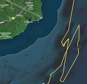
Investigator is one of the quietest vessels of its kind in the world, and can map areas of seafloor up to 30 kilometres wide in a single pass in water depths of 11,000 metres or more. On this voyage, we’re not quite going that deep though! Most of the mapping in the seven Commonwealth marine reserves we’re visiting off eastern Australia is at depths of 1000─5000 metres.
While there has been previous mapping of some parts of these marine reserves, the data collected on this voyage are at much higher resolution than ever before and will fill in a lot of gaps for scientists and marine park managers.
Parks Australia, which manages the Commonwealth Marines Reserve network, has been very excited by the mapping work for the East Gippsland CMR, which gives a new perspective on the reserve and the rich habitats in the relatively unknown abyss.
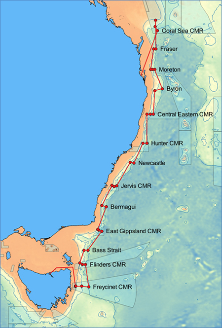
Many of Australia’s 60 CMRs have deep and remote waters and by better understanding these places, and the creatures that live there, the voyage will help Parks Australia to manage these important and poorly understood parts of our national marine estate.
Australia has one of the world’s largest marine territories, but less than 25 percent of our seafloor has been mapped to a modern standard. We need information about our undersea environment to make better decisions about managing undersea resources and ecosystems.
The new bathymetry images have been viewed by CSIRO’s Dr Tara Martin, who leads the Data Acquisition, Processing and Management Team for Investigator, and Marine Biodiversity Hub research leader Scott Nichol of Geoscience Australia.
They say the detailed images tell us about the long geological history of the region, and bring into focus details of active geological processes that continue to shape the seafloor.
Among the highlights are submarine canyons up to 2000 m deep, and numerous ridges and gullies that are eroding into the continental margin. The images also reveal a vast variety of different seafloor environments that will help us better understand the environments favoured by different kinds of marine life.
- Log in to post comments